
Interpretive Center

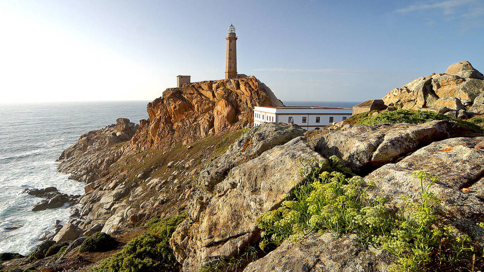
Lariño Lighthouse
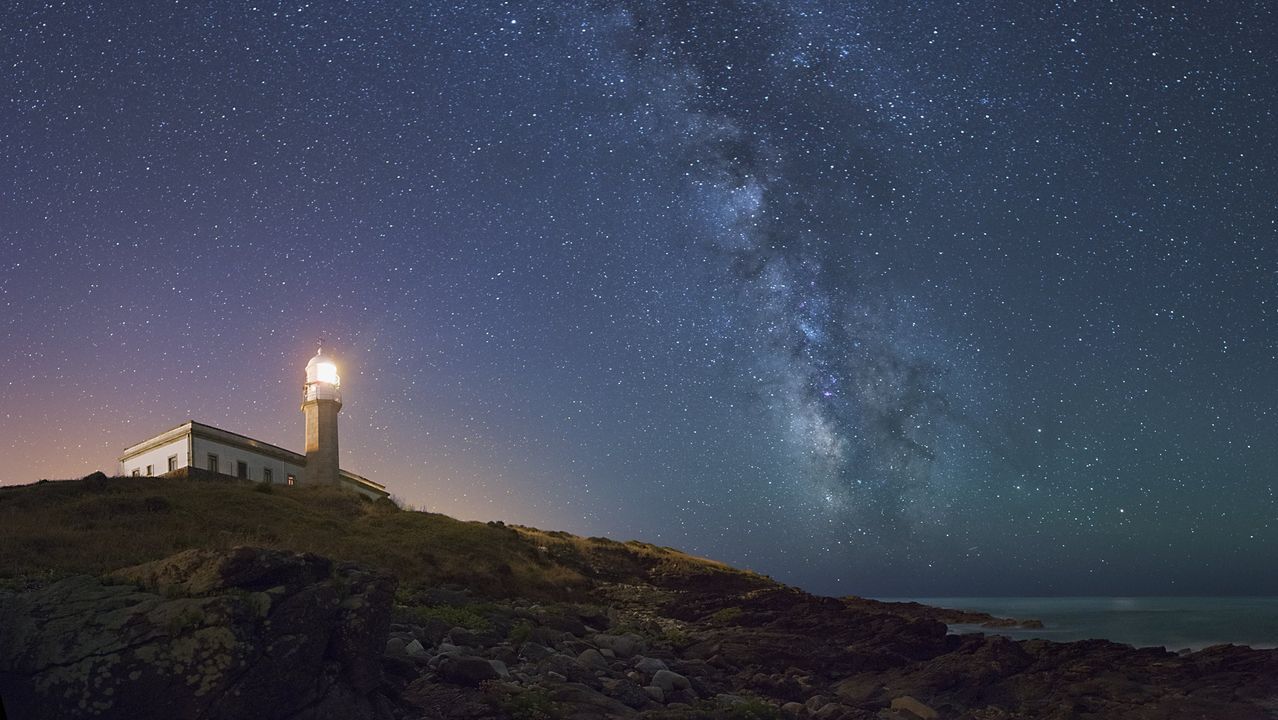
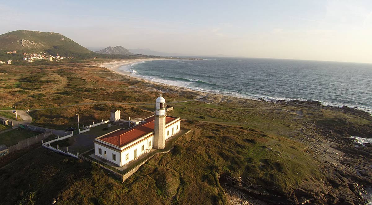

Also known as Punta Insua Lighthouse, it is a building that deserves to be visited due to its architectural peculiarity and the beauty of the place where it is located, especially its sunsets. It was built between 1913 and 1921. It is located in Punta Insua, which is the geographical point that helps to fix the entrance to the arch of Fisterra and the estuary of Corcubion, in order to complete the lighting system of the lighthouses of Corrubedo and Fisterra. It is a large U-shaped building, designed by the engineer Salvador López Miño, built in stone and painted white.
Attached to the west wall, the lighthouse tower rises majestically, 14 meters high, crowned by a dome with a metallic weather vane, where the year of its inauguration is written: 1920. Until the end of the 80's it was the residence of the successive lighthouse keepers and their families and from 2021 it is enabled as a tourist accommodation establishment, to become one of the most unique and exquisite hotels in Galicia, but retaining its main purpose as a lighthouse.
At present the lighthouse emits a white and red light that reaches a distance of 20 miles. The area next to the lighthouse has one of the best beaches on the coast and radiates tranquility and peace, with beautiful panoramic views that offer an unforgettable sunset over the ocean.
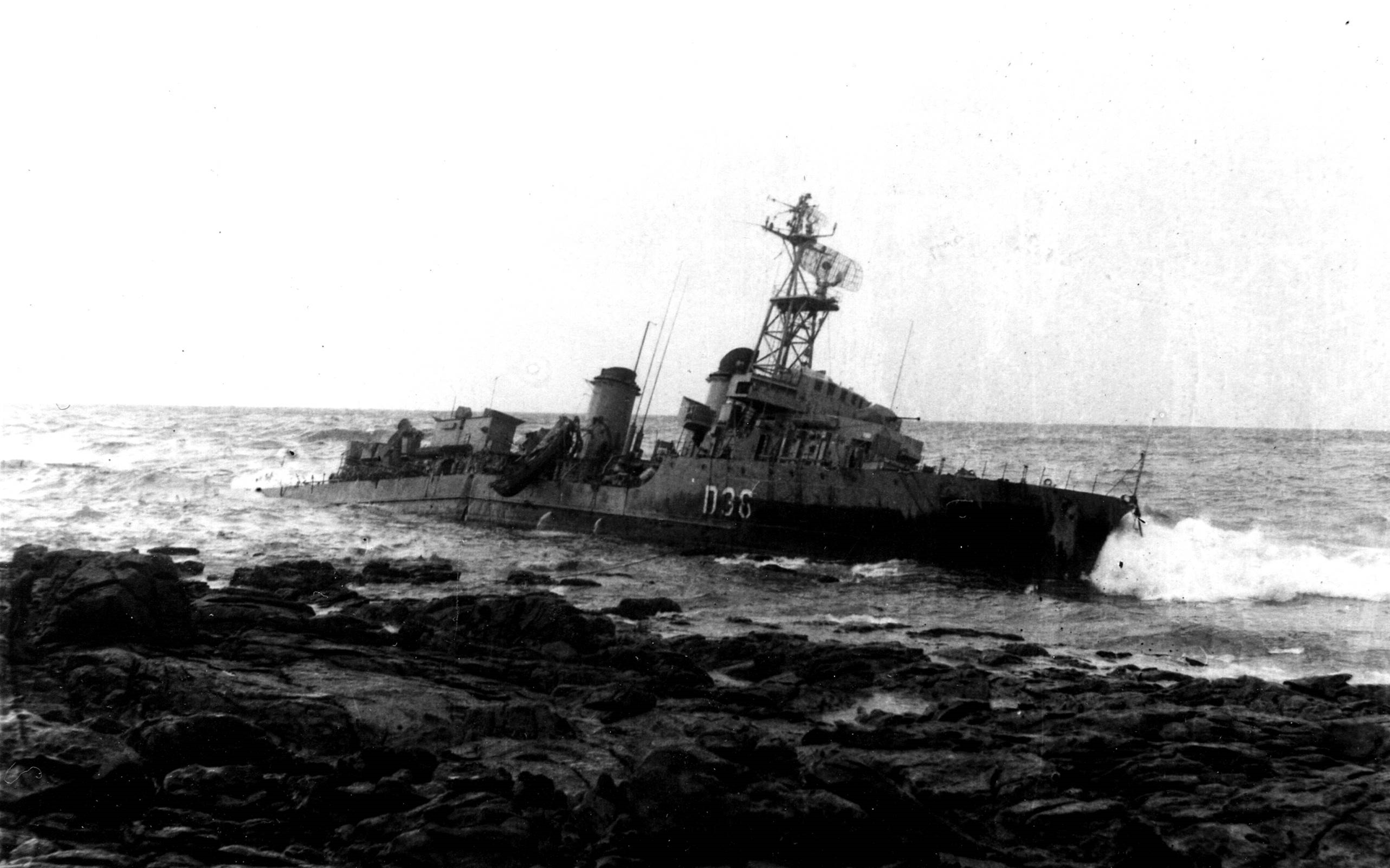
The Ariete

Every navigation off the Costa da Morte has paid a tribute. All the nations with maritime activity have numerous examples sunk in our waters, some belong to private shipping companies and others to their military navies, and the Spanish Navy was not going to be an exception. Its traffic in front of Galicia had to pay a tribute in sunken ships that today are part of our cultural heritage.
On February 25, 1966, around ten o'clock at night, the frigate Ariete ran aground on the beach of Ardeleiro in Lira. This frigate of the Audaz class, built in Ferrol and launched in 1955, was 94 meters long and had a displacement of 1552 tons.
After leaving Ferrol towards Cartagena on February 24, 1966, they encountered a progressive worsening of the weather, reaching force 9 winds with gusts of 120 km/h, which caused serious damage to the ship to the point of leaving it practically without any steering.
After alarm signals, an oil tanker and the destroyer Legazpi managed to give her a tow which in the end broke up, leaving the fate of the Ariete sealed.
The heroic behavior of the neighbors of Carnota who came to the rescue, in some cases throwing themselves into the sea without assessing the risk to their lives and with the characteristic courage of the people of these lands, made them earn 67 Cross of Civil Merit, 168 people were saved.
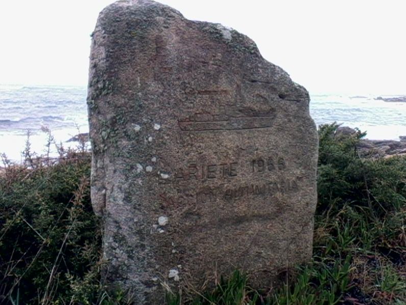
Four decades later, half a hundred crew members returned to Lira to relive that sinking. The military gathered in the vicinity of the sanctuary of the Virgen de los Remedios, where a monolith was inaugurated in memory of the tragedy.
On February 25, 1966, around ten o'clock at night, the frigate Ariete ran aground on the beach of Ardeleiro in Lira. This frigate of the Audaz class, built in Ferrol and launched in 1955, was 94 meters long and had a displacement of 1552 tons.
After leaving Ferrol towards Cartagena on February 24, 1966, they encountered a progressive worsening of the weather, reaching force 9 winds with gusts of 120 km/h, which caused serious damage to the ship to the point of leaving it practically without any steering.
After alarm signals, an oil tanker and the destroyer Legazpi managed to give her a tow which in the end broke up, leaving the fate of the Ariete sealed.
The heroic behavior of the neighbors of Carnota who came to the rescue, in some cases throwing themselves into the sea without assessing the risk to their lives and with the characteristic courage of the people of these lands, made them earn 67 Cross of Civil Merit, 168 people were saved.
Four decades later, half a hundred crew members returned to Lira to relive that sinking. The military gathered in the vicinity of the sanctuary of the Virgen de los Remedios, where a monolith was inaugurated in memory of the tragedy.
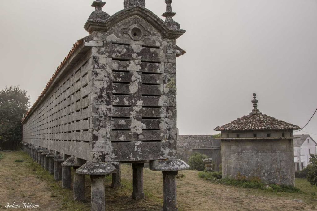
Carnota Horreo

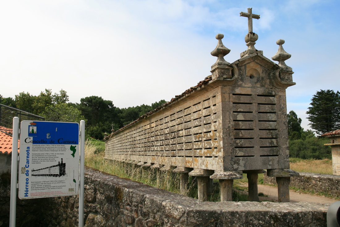
The hórreos are one of the most genuine traditional constructions of Galicia and very especially of Carnota in whose municipality more than 884 hórreos can be counted, although special mention should be made of the hórreos of Lira and Carnota both for their dimensions and for belonging to the Church. Its original use was to store, dry and preserve the corn and other products of the land, for it stored the grain so that being raised on pillars kept food away from moisture or animals making the slots ventilation functions. However, with the progressive disappearance of traditional agriculture, their original function was lost and they became decorative elements. Nowadays the law protects their conservation.
The Hórreo de Carnota, declared a National Monument, was built in 1768, but it was in 1783 when it was extended with new pairs of feet. It is 34.76 meters long and 1.90 meters wide and has 22 pairs of feet. There has always been a certain healthy rivalry between the neighbors of the parishes of Lira and Carnota over which of the two hórreos is worthy of the "largest" award. The Church of Santa Comba de Carnota, built in 1755, is of classicist baroque style. The main altar is presided over by a beautiful altarpiece, the work of the sculptor José Ferreiro. The church and the hórreo, together with the rectory and the dovecote, form an architectural ensemble of unquestionable beauty.
The Hórreo de Carnota, declared a National Monument, was built in 1768, but it was in 1783 when it was extended with new pairs of feet. It is 34.76 meters long and 1.90 meters wide and has 22 pairs of feet. There has always been a certain healthy rivalry between the neighbors of the parishes of Lira and Carnota over which of the two hórreos is worthy of the "largest" award. The Church of Santa Comba de Carnota, built in 1755, is of classicist baroque style. The main altar is presided over by a beautiful altarpiece, the work of the sculptor José Ferreiro. The church and the hórreo, together with the rectory and the dovecote, form an architectural ensemble of unquestionable beauty.
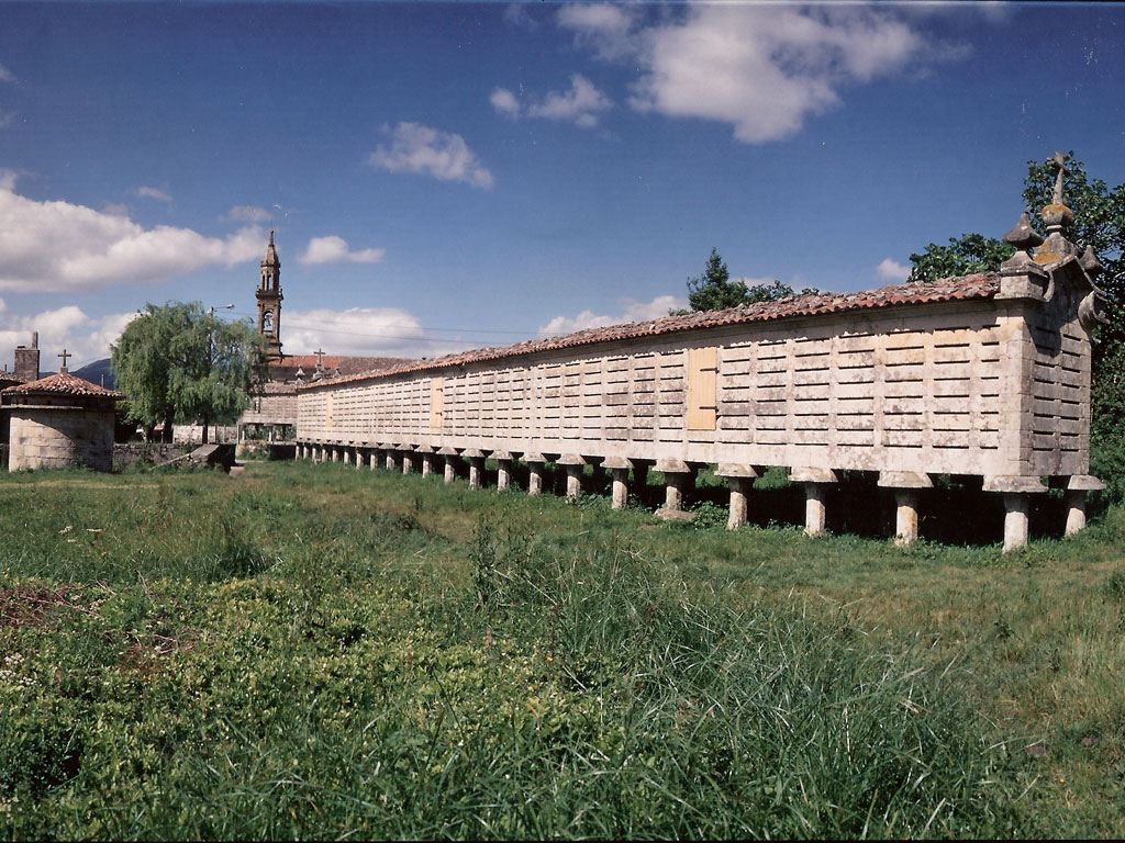
Lira Horreo


This hórreo, along with its neighbor in Carnota, are a must-see as they are the largest in Galicia. It is 22.5 cm shorter than the one in Carnota, but 22.5 cm wider. It is made up of the Church of Santa María de Lira, the hórreo, the rectory and the dovecote, just like the one in Carnota.
The Hórreo de Lira was built between 1779 and 1814 by the architect Gregorio Quintela, on a stone platform, in order to save the unevenness of the terrain. Like the one in Carnota, it has 22 pairs of feet but is 36.53 meters long and 1.60 meters wide. There has always been a certain healthy rivalry between the neighbors of the parishes of Lira and Carnota about which of the two hórreos is worthy of the "biggest" award. Since 2013, every summer, a great celebration of popular culture is held in the vicinity of the hórreo, organized by the Canal de Lira Cultural Association, which generates a lot of expectation.
The Hórreo de Lira was built between 1779 and 1814 by the architect Gregorio Quintela, on a stone platform, in order to save the unevenness of the terrain. Like the one in Carnota, it has 22 pairs of feet but is 36.53 meters long and 1.60 meters wide. There has always been a certain healthy rivalry between the neighbors of the parishes of Lira and Carnota about which of the two hórreos is worthy of the "biggest" award. Since 2013, every summer, a great celebration of popular culture is held in the vicinity of the hórreo, organized by the Canal de Lira Cultural Association, which generates a lot of expectation.
Pinto Mountain and Ézaro Waterfall


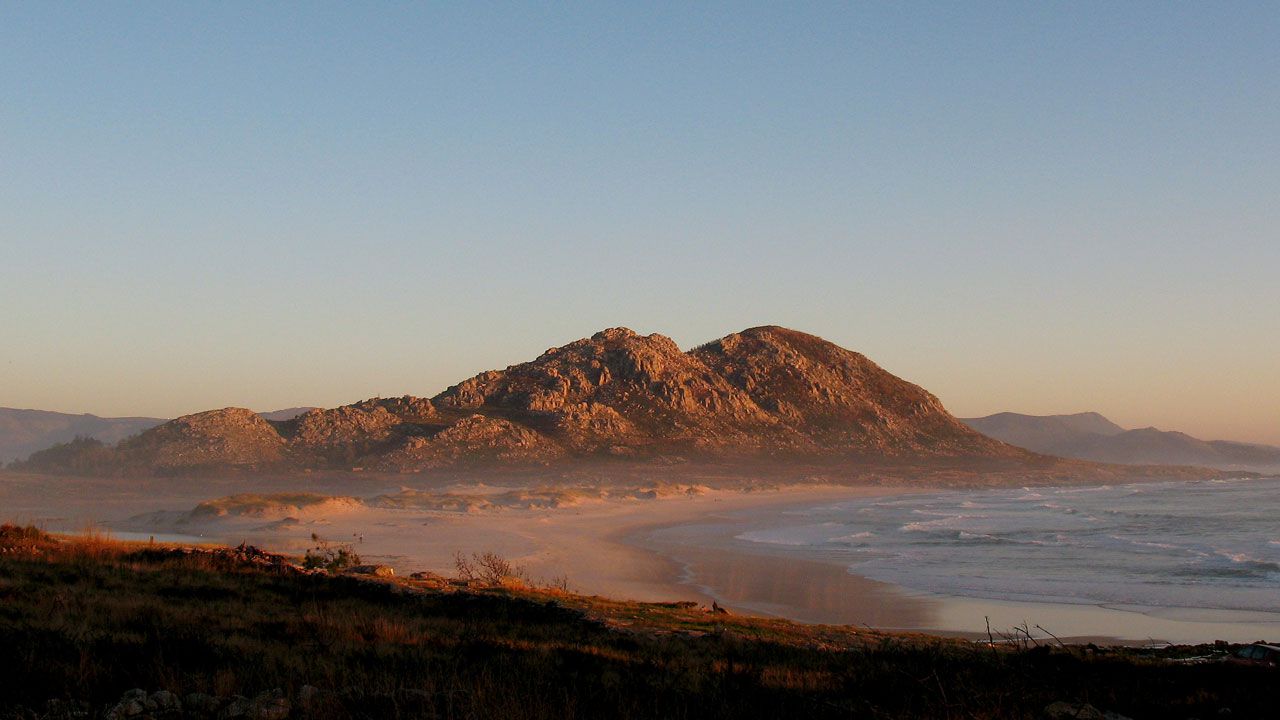
The spectacular Monte Pindo is a mountainous appendix of rounded granite rocks that ends at the edge of the sea. At the top, from the viewpoint of A Moa, at 627 meters above sea level, we can see the vastness of the Atlantic Ocean and the wide and rugged coastal panorama that stretches at his feet (Fisterra, Corcubión, Cee, Carnota beach, Caldebarcos point). This mountain is considered a mythical place, around which numerous legends have been developed about its ancient inhabitants, the Celts, and about the magical properties of the area. It has been called Celtic Olympus, for being a sacred mountain for the Celts, who made their sacrifices on stone altars. The vertical disposition of its stones reminds us of the human figures of the Celtic heroes, who refused to leave the place, remaining in stone form for eternity.
Without leaving the area we can not fail to visit Ézaro, is the only parish of the municipality that borders the sea, the Atlantic Ocean. Although what characterizes and what this parish is best known for is its waterfall "Fervenza do Ézaro" where the river Xallas permeates and determines the whole character of the municipality of Dumbría. It crosses it from north to south, until it flows in its maximum expression in the form of a waterfall, directly into the Atlantic Ocean. The waterfall of the Ézaro River is full of legendary stories; princesses' heartbreaks, supernatural powers, enchantments, rites, etc. It is also the only river in Europe that flows into the sea in this way.
Before becoming a waterfall, the river is retained by three reservoirs; Fervenza, Castrelo and Santa Uxía. These places are recommended for their scenic beauty, as well as for their abundant native flora and fauna. Especially remarkable are the so-called Pías or Caldeiras, which are natural cavities built over the centuries by the river, bathed by transparent turquoise waters. In the last stretch the river has a fall of 155 meters, and the height of the waterfall is 40 meters.
It is a spectacle that can be enjoyed both night and day, and is that the waterfall looks beautiful on a clear night and in the light of the moon, reflecting it in the water falling from above.
The area is a unique place for hiking and is part of a special protection area, included in the Natura 2000 Network, which has a great geological, botanical, faunistic and landscape interest, which makes it a tourist resource of reference of the geo-destination.
Carnota Beach

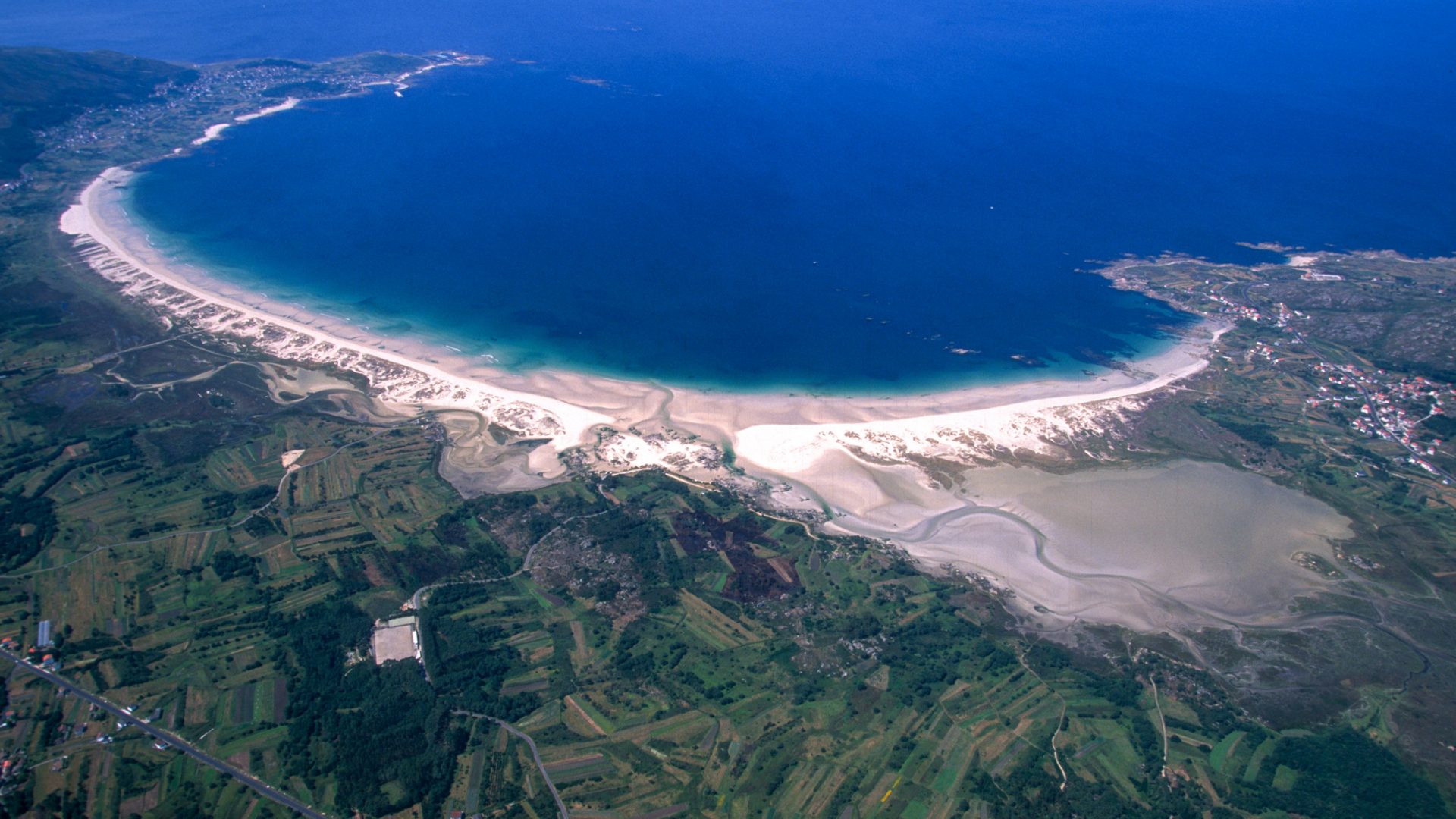

The Carnota Beach is a work of art in the middle of nature, with more than 7 km of sandy beach and crescent-shaped, is the largest beach in Galicia. This natural space of great beauty has a great environmental interest.
It is a unique set of dunes and marshes with an inner lagoon that hosts plant and animal communities of great interest. It also serves as a refuge for a large number of species of migratory birds and is one of the few places in Galicia where the lesser black-headed stilt nests. Its attractiveness needs no explanation, the color of its area, the sound of the sea, a paradisiacal landscape practically virgin at the foot of Monte Pindo, which serves as a refuge for a large number of species of migratory birds. In addition to being one of the few places in Galicia where nests the mockingbird, a bird that is in danger of extinction due to the constant alteration of its habitat.
It is a unique set of dunes and marshes with an inner lagoon that hosts plant and animal communities of great interest. It also serves as a refuge for a large number of species of migratory birds and is one of the few places in Galicia where the lesser black-headed stilt nests. Its attractiveness needs no explanation, the color of its area, the sound of the sea, a paradisiacal landscape practically virgin at the foot of Monte Pindo, which serves as a refuge for a large number of species of migratory birds. In addition to being one of the few places in Galicia where nests the mockingbird, a bird that is in danger of extinction due to the constant alteration of its habitat.
Senda Verde, a route in space and time


What today is one of the most popular routes of Carnota, was once the way of passage between the municipalities of Carnota and Muros.
Before the construction of the current road along the coast, the neighbors of Carnota, although mostly women, often lifted the baskets with local products, eggs or milk and went to the fair to Muros. Instead, they brought other products that were not available in their homes, which was known as "barter". That same road that these women traveled so much for work, is today a place to stroll and enjoy the surroundings.
Many decide to travel the 14 km that separate El Fondeadero from Louredo, walking and others by bicycle, but all of them say they are astonished by the spectacular views that the route offers of Lariño Beach, Carnota Beach, Portocubelo and Monte Pindo. The current path does not correspond in its entirety with the old path. From the Senda Verde today you can take several detours, some of them leading to the various population centers and others to the various archaeological sites that make up the Open Archaeological Museum of Carnota.
Viewpoints: Louredo and Lira

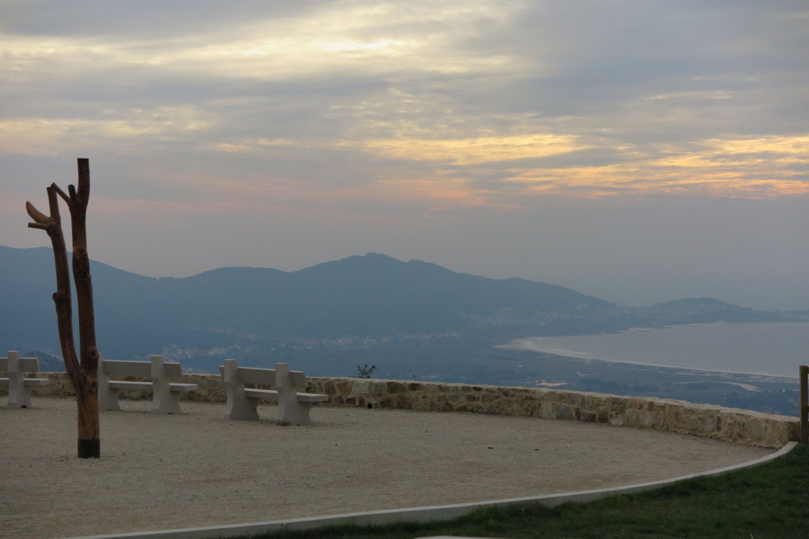
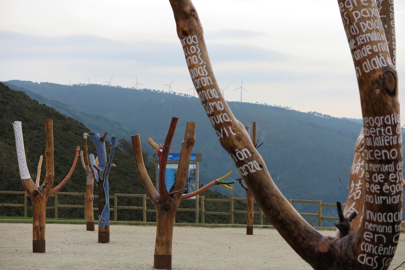
There are three ways to get to Carnota, two of them are bordering the coast and another accessing from the interior. If you decide to do it by the second one, the entrance in the municipality is spectacular. At the moment the descent towards Carnota begins, the picture of the kilometric Carnota Beach takes all the protagonism and there, in the same place where the Atlantic opens the way, you will see for the first time the longest beach in Galicia with more than 7 km of fine white sand. It is no coincidence that there is a viewpoint in this place. Visitors have always felt the need to make a stop to contemplate the privileged views offered by this place and immortalize the moment. The viewpoint is equipped with a small picnic area, information panels, a succession of U-shaped benches overlooking the beach of Carnota and also has a representation of the Carnota artist "Nando Lestón" who recovered burned trees during the last fire in Monte Pindo and gave them a second chance.
From the Mirador de Lira on clear days you can enjoy spectacular panoramic views of the southern part of the Costa da Morte. You will be able to see simultaneously the Lighthouses of Lariño and Fisterra. The viewpoint is located in the high part of Monte de Lira taking advantage of the orography of the land. It has a rest area nearby and a representation of vertical slabs that include replicas of petroglyphs, work of the sculptor "Xosé Cernadas". Despite being one of the viewpoints of the City Council that offers some of the best aerial views, it is not the most visited due to the narrow accesses that lead to it.
From the Mirador de Lira on clear days you can enjoy spectacular panoramic views of the southern part of the Costa da Morte. You will be able to see simultaneously the Lighthouses of Lariño and Fisterra. The viewpoint is located in the high part of Monte de Lira taking advantage of the orography of the land. It has a rest area nearby and a representation of vertical slabs that include replicas of petroglyphs, work of the sculptor "Xosé Cernadas". Despite being one of the viewpoints of the City Council that offers some of the best aerial views, it is not the most visited due to the narrow accesses that lead to it.
Miñarzos Reserve

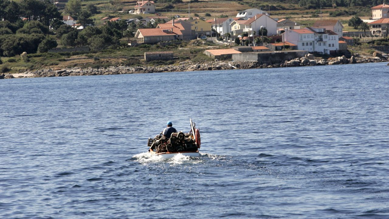
The Miñarzos, which is the first Reserve of Fishing Interest of the Atlantic coast in the Iberian Peninsula, was created on the initiative of the Lira fishermen's guild and marine biologists. The objective of the reserve is to regulate fishing activities in order to conserve the exploited species, with the aim of guaranteeing the sustainability of the marine ecosystem. By limiting access and regulating fishing activities, the species can reach larger sizes, which is important because the larger the species, the greater the number of eggs per clutch. In addition to the potential benefits related to fisheries, there are other advantages for the ecosystem, such as habitat conservation and increased biodiversity. To ensure the best management, there is a land-based maritime surveillance system, a catch control post in the port, and a census of vessels that can fish within the reserve, belonging to various fishermen's associations in the region.
Los Miñarzos covers an area of 2,074 hectares, and there are two integral reserves that occupy 79 hectares. Within the reserve zone, more restrictive measures are defined than those established by the general fishing regulations, referring to periods of activity, minimum sizes of specimens and catch quotas per boat. In the integral reserves, all extractive activities and underwater activities are prohibited; only activities for scientific purposes are allowed with express permission. Underwater fishing is prohibited throughout the marine reserve, but recreational, observation and, of course, photographic diving is permitted, except in the integral reserves. The Lira (Mardelira) fishermen's guild promotes the appreciation of fishing culture through the Mardelira project, which allows visitors to learn about a normal day's work at sea and the life of a small fishing port. It also organizes fishing workshops for schoolchildren, guided tours and boat trips for sport anglers in which no-kill fishing is practiced.
Los Miñarzos covers an area of 2,074 hectares, and there are two integral reserves that occupy 79 hectares. Within the reserve zone, more restrictive measures are defined than those established by the general fishing regulations, referring to periods of activity, minimum sizes of specimens and catch quotas per boat. In the integral reserves, all extractive activities and underwater activities are prohibited; only activities for scientific purposes are allowed with express permission. Underwater fishing is prohibited throughout the marine reserve, but recreational, observation and, of course, photographic diving is permitted, except in the integral reserves. The Lira (Mardelira) fishermen's guild promotes the appreciation of fishing culture through the Mardelira project, which allows visitors to learn about a normal day's work at sea and the life of a small fishing port. It also organizes fishing workshops for schoolchildren, guided tours and boat trips for sport anglers in which no-kill fishing is practiced.
Montelouro and Xalfas Lagoon


Montelouro is the most emblematic colossus of the municipality of Muros, crowned by two peaks that in front of the immensity of the sea protect from the winds the beach of San Francisco located in the inner part of the estuary. On the outside you will find the Xalfas lagoon separated from the sea by beautiful dune formations, and that on stormy days communicates with it when the strong waves make their way into the interior. The Xalfas lagoon, catalogued as a place of community importance, is formed due to the stagnation of the waters of the river Longarella and with a maximum depth of 2 meters it shelters an infinity of birds.
Legend has it that in the lagoon there is a sunken village and that on stormy days you can hear the bells and the voices of the inhabitants.
Legend has it that in the lagoon there is a sunken village and that on stormy days you can hear the bells and the voices of the inhabitants.
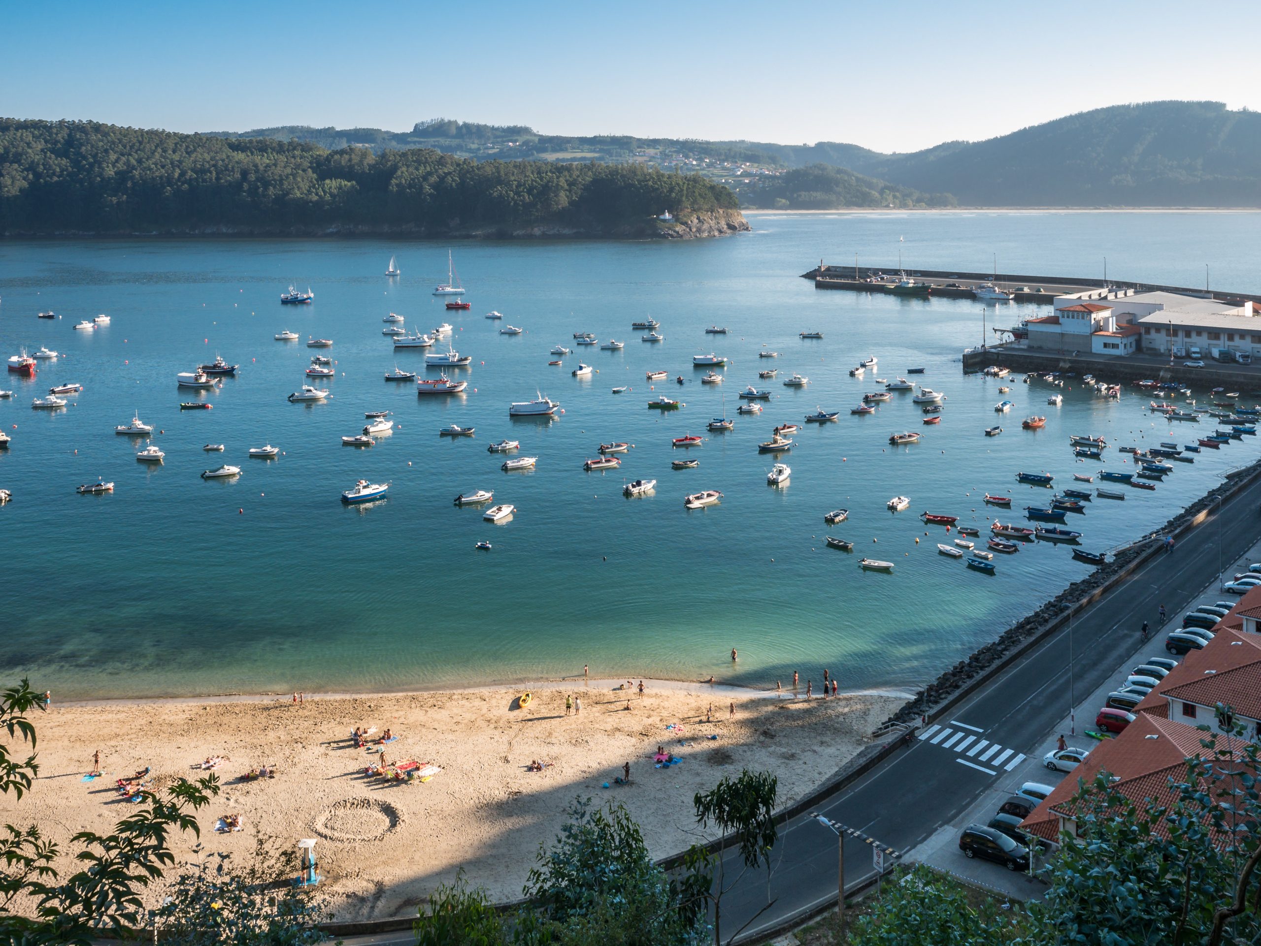
Muros
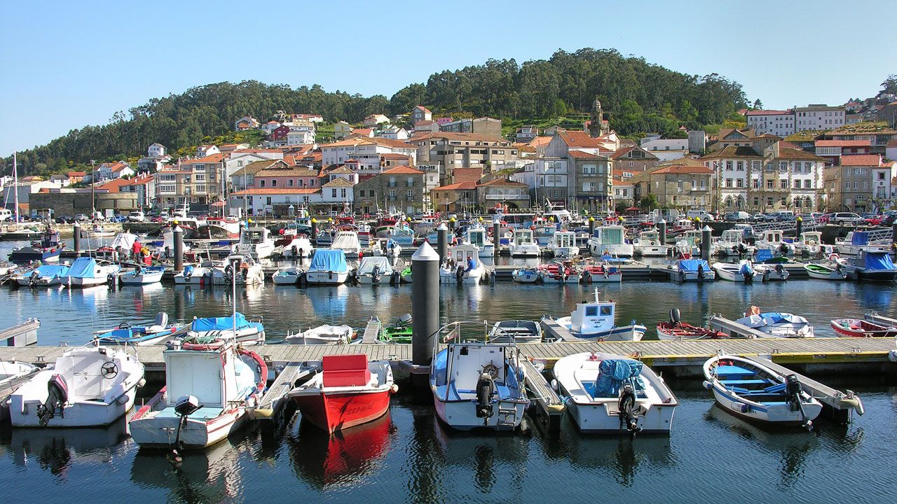


The medieval village with a noble character of Muros enchants everyone who visits it. Its privileged enclave and the historical heritage of the town make it one of the Galician municipalities with the greatest potential for tourism. It was declared "historic-artistic site" in 1970 and retains the charm of its narrow streets, old stone staircases and arcades that make Muros has its unique stamp in Galicia.
From the Curro de la Plaza and towards the Calle Real you can take a lovely walk that takes you back to another time as you stroll through its streets steeped in history. The Plaza del Mercado (old Plaza Mayor) where it is obligatory to stop to enjoy the beautiful architecture, after which you can rest visiting the two most special squares of the town: The Plaza del Cristo with its beautiful cruise carved in 1789 and the Plaza de la Pescadería Vieja converted into a restaurant area where you will find a curious stonework fountain that reproduces the silhouette of a reptile with wings.
From the Curro de la Plaza and towards the Calle Real you can take a lovely walk that takes you back to another time as you stroll through its streets steeped in history. The Plaza del Mercado (old Plaza Mayor) where it is obligatory to stop to enjoy the beautiful architecture, after which you can rest visiting the two most special squares of the town: The Plaza del Cristo with its beautiful cruise carved in 1789 and the Plaza de la Pescadería Vieja converted into a restaurant area where you will find a curious stonework fountain that reproduces the silhouette of a reptile with wings.
Tide Mill, Pozo de Cachón
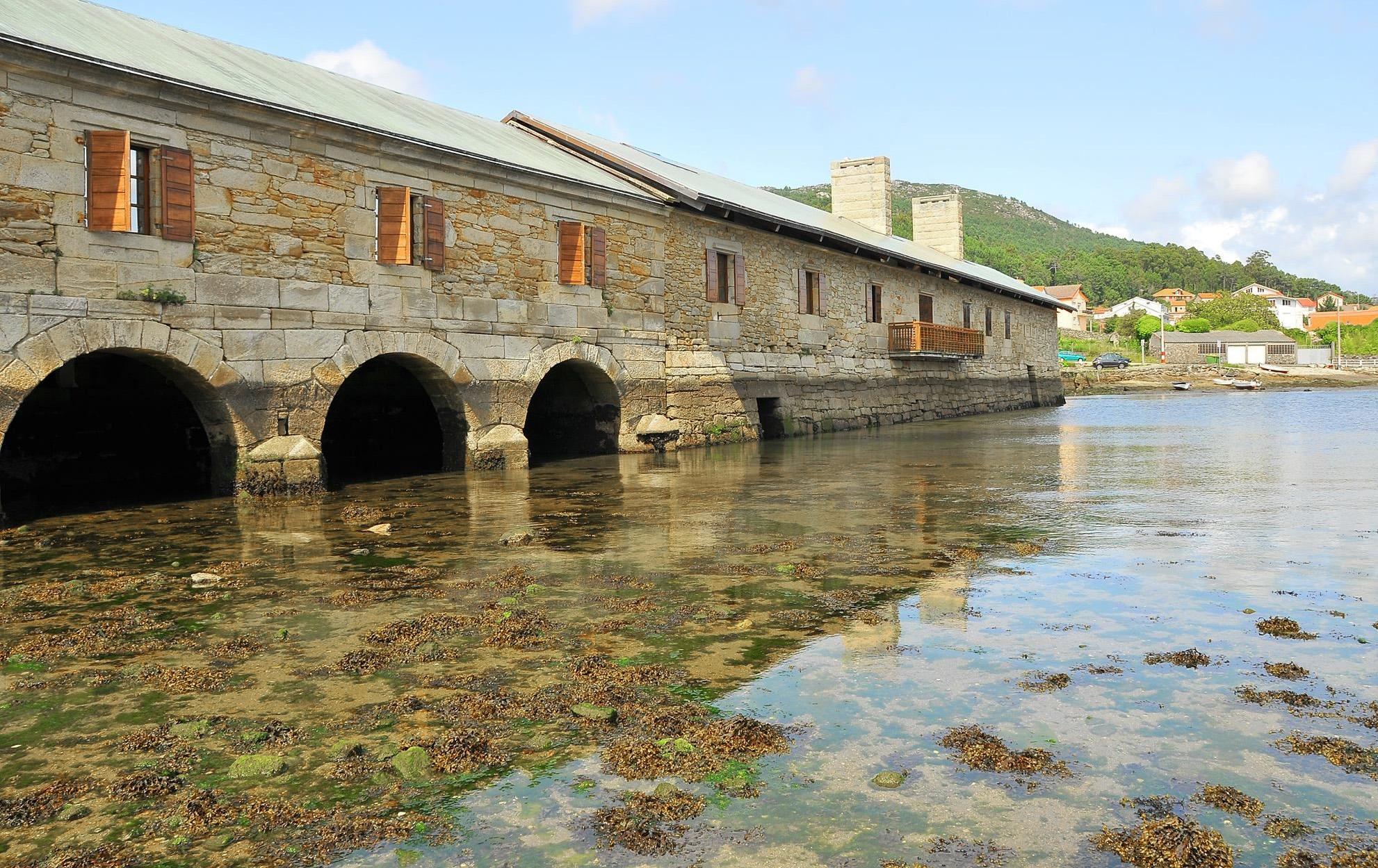


In such a fishermen's town, even agriculture takes advantage of the sea. In this case it does it to grind grain. The expansion of corn meant that the small river mills were not enough, and at the beginning of the 19th century the one known as Muíño de Bazarra was built, after the name of its builder, D.Ignacio Perez Bazarra, today better known as Muíño de Pozo do Cachón. It is, by its size and state of conservation, one of the most important of the Peninsula.
Its operation takes advantage of the movement of the tides.
The key is in the dam of more than 230 m. During high tide the water accumulates and the dike is closed to prevent its escape. When the water level has dropped, the floodgates are opened, so that the retained water flows out driving the 'moas', crushing the grain.
In the Pozo do Cachón, over these 'moas' stands a plant that served as a warehouse and even as a bathhouse for treatments with seawater and algae. Today it is a cultural center open to the public.
Rock Art: The Petroglyphs
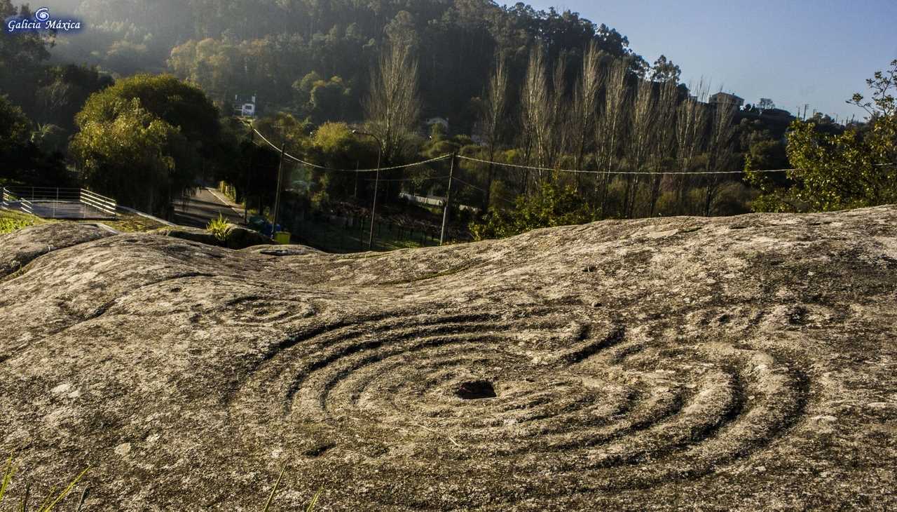
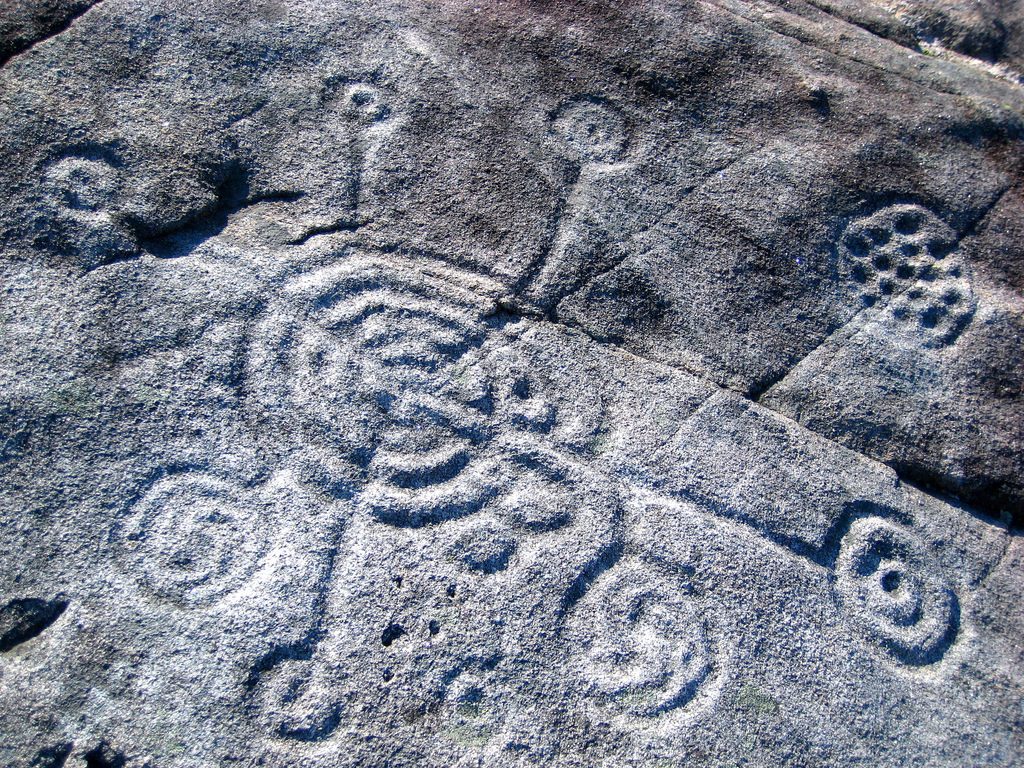
The Galician petroglyphs is an art that is framed within the artistic manifestations of the Bronze Age and a good part of the Iron Age. With very varied forms, these figures engraved in the rock are perhaps the most original artistic expression of the Galician world and always within the schematism or abstraction. In the Galician petroglyphs, varied circular figures, labyrinths, bowls, weapons, hunting scenes, various animals, as well as human representations of difficult interpretation are represented.
The engravings are usually located on granitic rocks in areas close to water courses, on the slopes of mountain slopes or hills, the technique consists of a picketing with an instrument that acts as a chisel or with a continuous action of abrasion by rubbing with a cutting instrument.
In Muros we have Cova da Bruxa, which is one of the most interesting sets of Galician rock art, both for its extension, being one of the largest in the area, and for its wide range of highly complex motifs. Figures such as deer, canids, equines and a human figure surrounded by circular representations seem to want to express some clue of what our ancestors were at the time.
Finisterre


The town of Finisterre, a name derived from the Latin finis terrae, has captivated since ancient times a multitude of people who longed to see the end of the world, where the land ends and the sea begins, or at least that is what the Roman legions believed when they contemplated the sinking of the sun in its waters.
Ancient Greco-Roman geographers locate here the Promontorium Nerium and the Ara Solis, the altar of worship to the sun, built by the Phoenicians and that the Apostle Santiago himself had it destroyed shortly after.
The uniqueness of Finisterre arises from the many legends that surround these lands, in which religious, maritime and stone elements are combined. Thanks to the memory of the people of this place, these legends are still alive, captivating, along with the wonderful views that Fisterra has, to anyone who comes to visit the End of the World.
Finisterre is formed by an old nucleus grown in an amphitheater over the port. Its houses and narrow streets are very typical and original. In the center is the Plaza de Ara solis, on the outskirts, we find the most interesting monument of the town: the Church of Santa Maria de las Areas and within the historical complex of the town, also highlights the Castle of San Carlos. But a must-see is the lighthouse built in 1853, 138 m. above the sea, which protects one of the most dangerous coasts in the world.
It is known by all the navigators of the world, for its importance as a means of warning of the proximity of an extremely dangerous coast, its light reaches 65 km in length, as well as for the reputation of treacherous of this maritime area.
It is the most western and emblematic lighthouse in Europe, traditionally considered as the cape of the end of the world, "Finis Terrae".